8. Is og aske |
8. Ice and Ash |
Ísland har både jøkler og vulkaner i mængde. Blandingen af vulkansk aske og sne/is giver nogle spændende strukturer.
|
Ísland (En: Iceland) has glaciers (ís: Jökull/jöklar) and volcanoes by the score. The mix of volcanic ashes and snow/ice gives some peculiar structures.
|
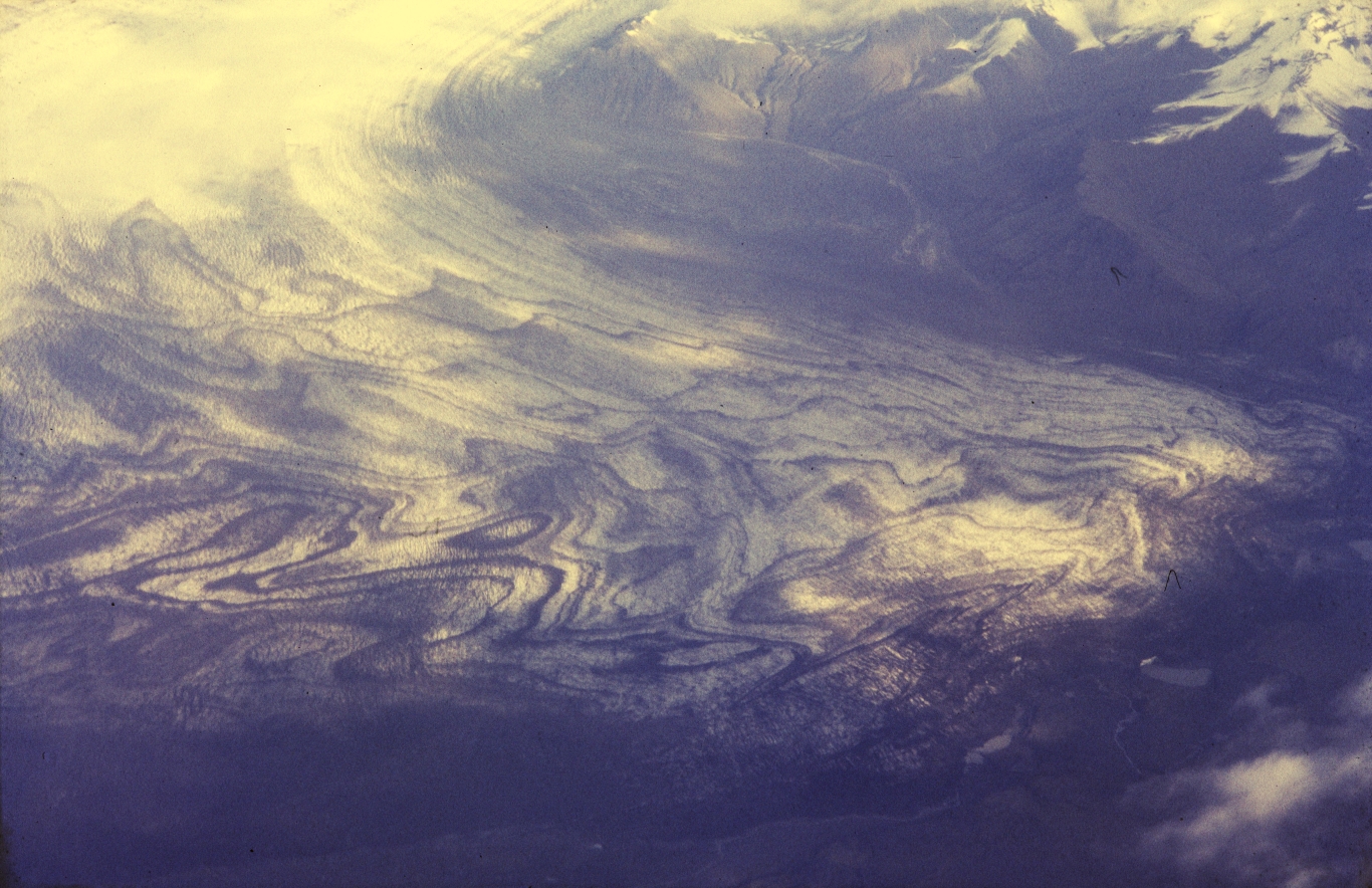 |
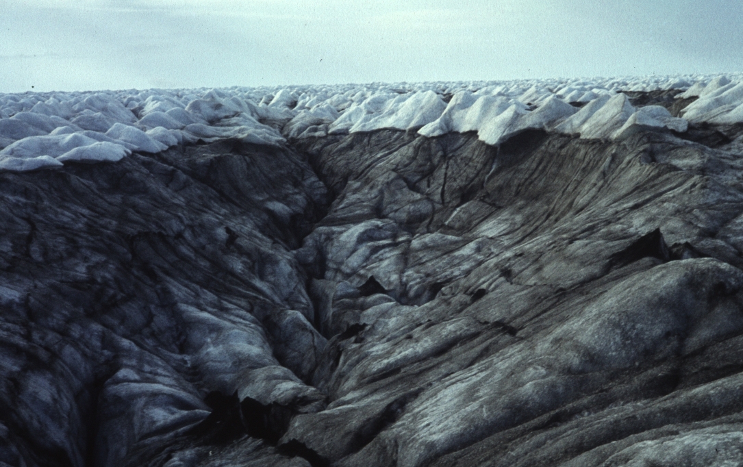
Askebånd. Hvert bånd er et askelag fra eet vulkanudbrud, aflejret i sneen. Det indviklede mønster viser nu hvordan isen flyder og smelter. Luftfoto.
|
Ash Layers. Each band is a layer of ash from one single volcanic eruption, sedimented in the snow. The intricate pattern now shows how the ice flows and melts. Aerial photo.
|
Skeiðarárjökull, Vatnajökull, Ísland. Sep 1988.
|
 |
Askebånd. Se ovenfor.
|
Bands of Ashes. As above.
|
S Ísland.
|
 |
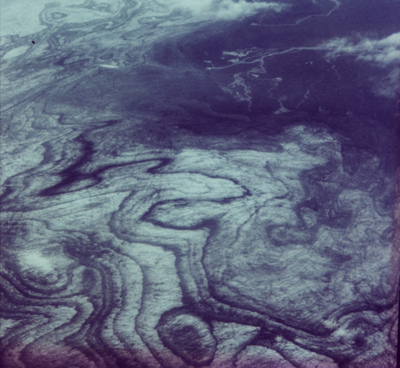
Askebånd. Se ovenfor.
|
Bands of Ashes. As above.
|
Skaftafellsjökull, Vatnajökull, Ísland. Jul 1983. Steen C foto.
|
 |
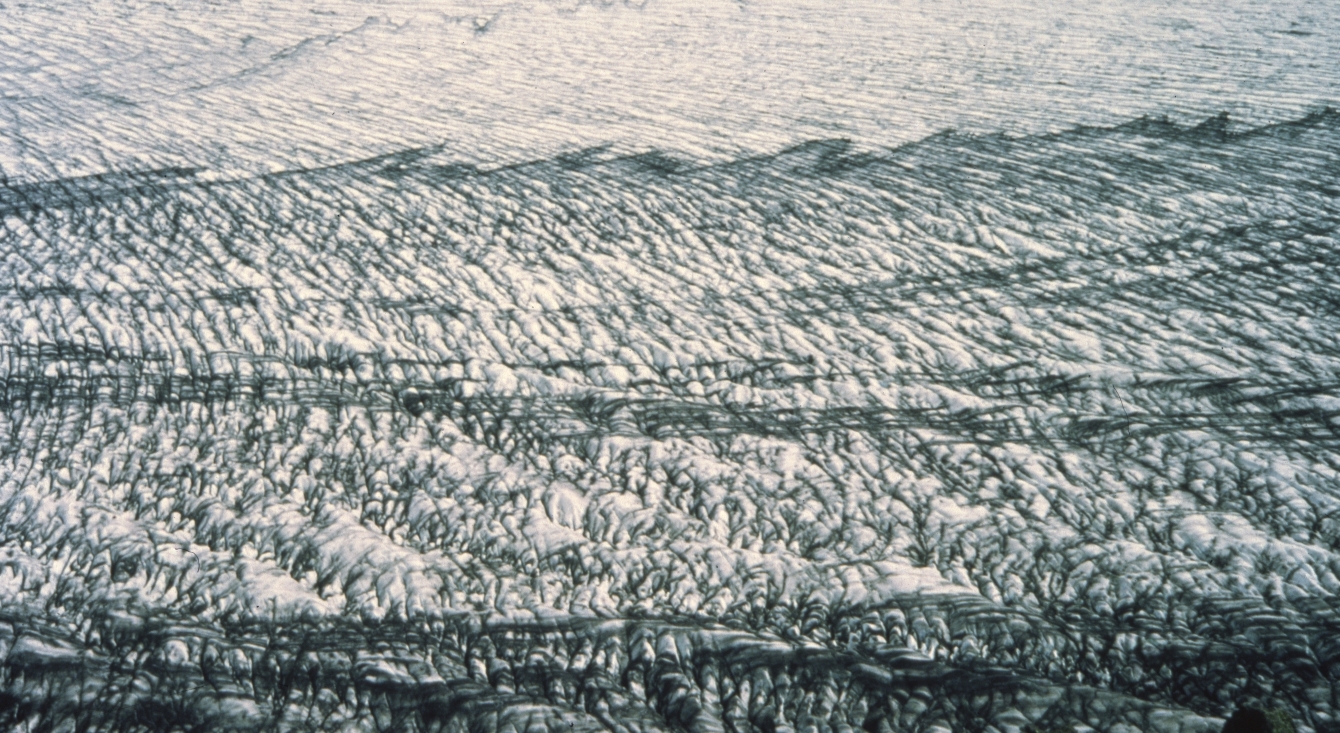
Askebånd. Bånd af indlejret aske ses her i et sving.
|
Bands of Ashes. Bands of ash and ice are here seen in a bend.
|
Skeiðarárjökull, Vatnajökull, Ísland. Jul 1983.
|
 |
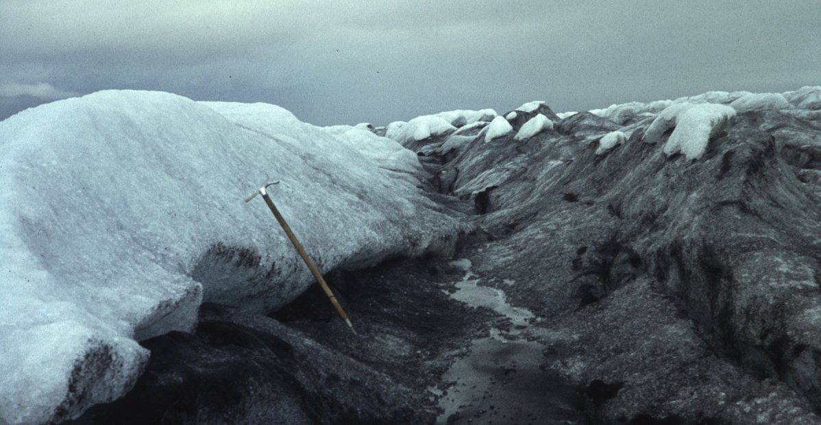
Askebånd. Et enkelt askebånd set på langs. Askelaget hælder på grund af isens bevægelser, her stikker kanten frem
|
Ash Band. A singe ash band. The ash layer is dipping due to the movements of the ice, here the edge crops out.
|
Skeiðarárjökull, Vatnajökull, Ísland. Sep 1988.
|
 |
Vandret askelag, hvid is over, grå is under. Selve askelaget er kun få cm tykt, men asken bliver liggende på overfladen af den underliggende is, som efterhånden smelter ned.
|
Horizontal Ash Layer, white ice above, grey ice below. The ash layer is only a few cm thick, but the ash remains on the surface of the underlying ice - as it melts down.
|
Skeiðarárjökull, Vatnajökull, Ísland. Jul 1983.
|
 |
Askelag der hælder tv. Se ovenfor. Hældningen ses på udliggerne til højre. Isøkse 1 m.
|
Ash Layer dipping left. As above. The dip is seen from the outliers to the right. Ice axe is 1 m long.
|
Skeiðarárjökull, Vatnajökull, Ísland. Jul 1983.
|
|
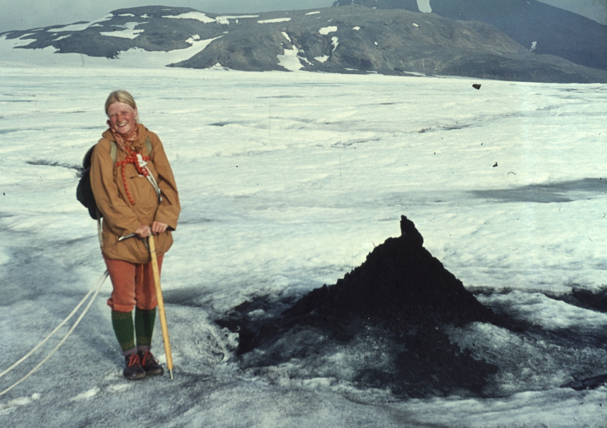 |
Sandkegle. En lille bræbrønd er blevet fyldt med sand/aske. Senere er den omgivende is smeltet ned, og tilbage står en prop af sand op af en kegle af is, dækket af aske. Keglen dannes fordi isen smelter langsomt, da den nedskridende aske isolerer mod sollys og varme. (Kegler findes også i ikke-vulkanske områder, hvor sand er føget el skyllet sammen).
|
Sand Cone. A Little moulin has been filled with sand/ashes. The surrounding ice has melted down and left a plug of ash, on top of a cone of ice covered with ashes. The cone is formed because the ice melts slowly since it is covered by ashes that insulate against sun and heat. (Cones are also seen in non-volcanic areas, where sand has been blown or washed together).
|
Hagavatnsjökull Eystri, Langjökull, Ísland. Jul 1973.
|
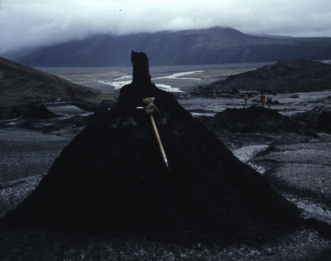 |
Askekegle. Som ovenfor - bare større. I proppen ses sedimentær lagdeling. Isøkse 1 m, 3 personer th.
|
Ash Cone. As above - just larger. Sedimentary layering is seen in the plug. Ice axe is 1 m, 3 hikers are seen to the right.
|
Skeiðarárjökull, Vatnajökull, Ísland. Jul 1983.
|
 |
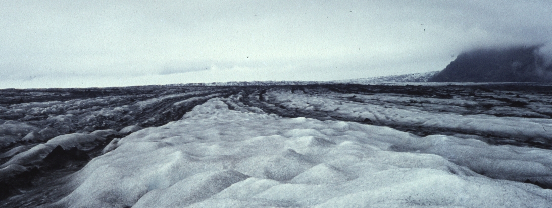
Aske dækker isen. Nær ved bræfronten er isoverfladen smeltet langt ned, så den aske som isen indeholdt ligger tilbage og dækker næsten det hele. Der er to kegler med tydelige propper.
|
Ash covering the ice. Near the glacier front the ice surface has melted way down, the contained ash remains and covers almost everything. Two cones with plugs are seen.
|
Skeiðarárjökull, Vatnajökull, Ísland. Jul 1983.
|
 |
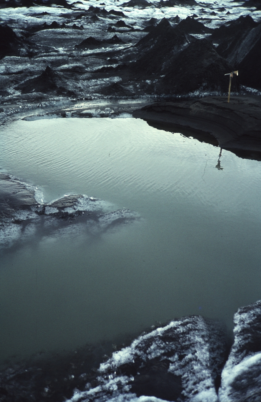
Vandfyldt brønd. Lille brønd, der er blevet tilstoppet af aske og nu er vandfyldt. Kegle og prop ses th. Isøksen tv er 1 m lang.
|
Moulin filled with Ash and Water. Small moulin, filled with ash that blocks the flow, and then filled with water. To the right an ash cone with plug. 1 m ice axe to the left.
|
Skeiðarárjökull, Vatnajökull, Ísland. Jul 1983.
|
 |
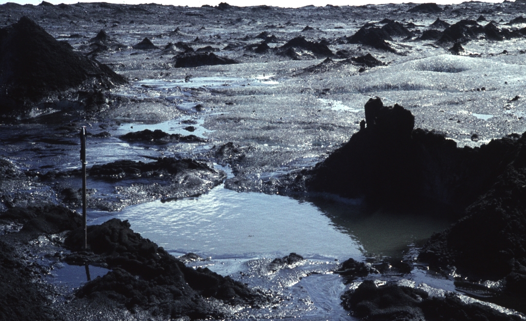
Vandfyldt brønd. Som ovenfor men større. Isøksen th er stadig 1 m lang.
|
Moulin filled with Ash and Water. As above, just larger. Ice axe to the right is still 1 m.
|
Skeiðarárjökull, Vatnajökull, Ísland. Jul 1983.
|
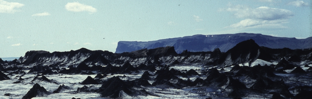 |
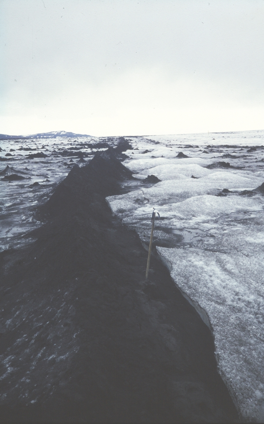
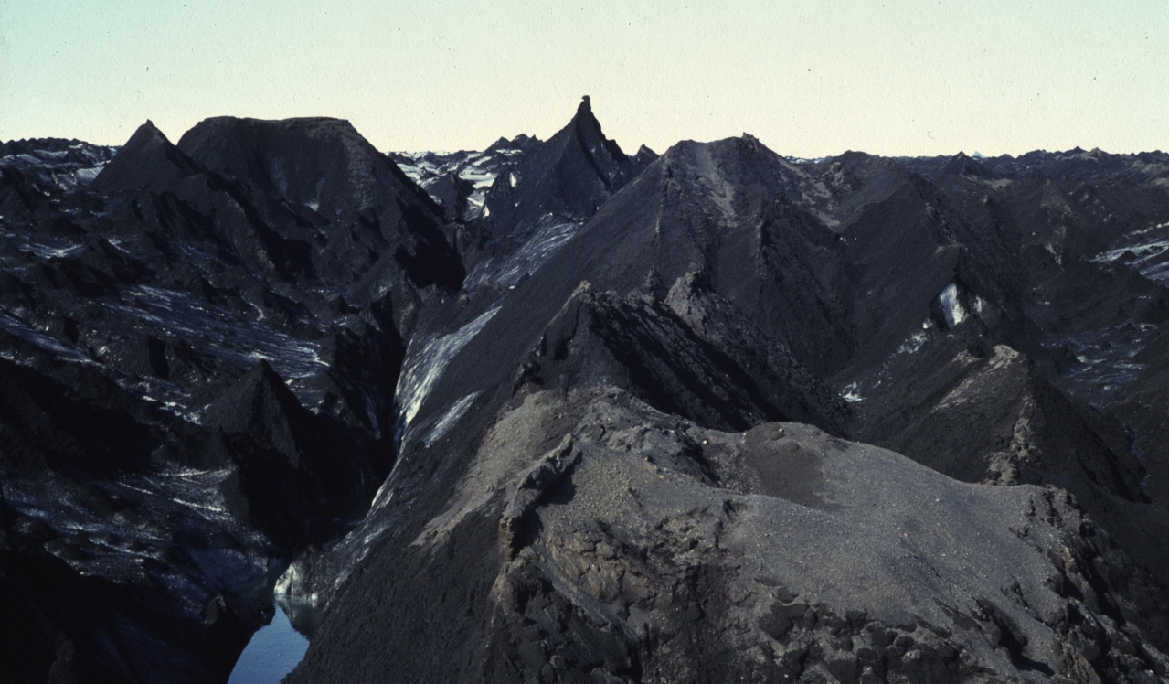
Askeryg. Midti ses en lang isryg (5-20 m høj, ½ km lang) med sort aske på toppen. På ryggen ses flere højere kegler med antydning af prop foroven (se Sandkegle ovenfor). I forgrunden små sandkegler. Isen flyder til venstre.
Det må være en tidligere (næsten) vandret afløbskanal inde i isen, som først er blevet fyldt med sand/aske, hvorefter den omgivende is er smeltet væk.
|
Ash Ridge. In the middle a long ice ridge (5-20 m high, ½ km long), with black sand/ash on top. On the ridge several cones, each with remnants of a plug at the top (see Sand Cone above). In the foreground small sand cones. Flow is to the left.
This must be a former (almost) horizontal water tunnel internally in the ice. First it got filled with ash, later the surrounding ice melted away.
|
Skeiðarárjökull, Vatnajökull, Ísland. Jul 1983.
|
Indhold:
0. Glaciologisk forside
1. Brætyper
2. Sne & is
3. Sprækketyper
4. Snebroer
5. Is og smeltevand
6. Moræner og dødis
7. Andre overflade-strukturer
8. Is og aske <-- HER
9. Landskab nær isen
|
Contents:
0. Glaciological frontpage
1. Glacier Types
2. Snow & Ice
3. Crevasse Types
4. Snow Bridges
5. Ice and Meltwater
6. Moraines and Dead Ice
7. Other Surface Structures
8. Ice and Ash <-- HERE
9. Landscape near glaciers
|